


ROCKFORD WD 12 PCT 4, Winnebago County, Illinois
About
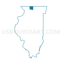
Outline

Summary
| Unique Area Identifier | 575847 |
| Name | ROCKFORD WD 12 PCT 4 |
| County | Winnebago County |
| State | Illinois |
| Area (square miles) | 0.13 |
| Land Area (square miles) | 0.13 |
| Water Area (square miles) | 0.00 |
| % of Land Area | 100.00 |
| % of Water Area | 0.00 |
| Latitude of the Internal Point | 42.29128800 |
| Longtitude of the Internal Point | -89.07015140 |
Maps


Graphs
Select a template below for downloading or customizing gragh for ROCKFORD WD 12 PCT 4, Winnebago County, Illinois


Neighbors
Neighoring Voting District (by Name) Neighboring Voting District on the Map
- ROCKFORD WD 03 PCT 7, Winnebago County, IL
- ROCKFORD WD 12 PCT 1, Winnebago County, IL
- ROCKFORD WD 12 PCT 2, Winnebago County, IL